2021 Boston Marathon traffic advisory
Street closures and parking restrictions will be in effect in Boston in the week leading up to the October 11 Boston Marathon.
The 2021 Boston Marathon is scheduled to take place on Monday, October 11, 2021. The Marathon will be the only event taking place on the public roadways for the weekend. The traditional races, such as the BAA 5K and the Invitational Mile, will not be happening.
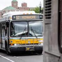
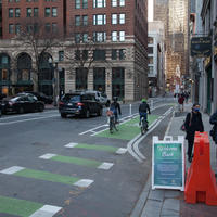
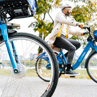
People coming into the City for the events are urged not to drive their personal vehicles. Information on Bluebikes rentals may be found online, and information on the MBTA may be found on the T's website. For a faster return trip, the MBTA advises riders to purchase a round-trip rather than a one-way ticket. Walking is also a great way to move around Boston.
Changes to the restrictions on this page may be made by the City of Boston’s Police and Transportation Departments. It is important to read all posted signs and variable message boards carefully.

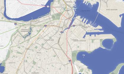
Boston Marathon map
Boston Marathon parking restrictions
Parking restrictions- Blagden Street, from Huntington Avenue to Exeter Street
- Boylston Street, Exeter Street to Claradin Street
- Exeter Street, Boylston Street to Blagden Street
- Blagden Street, Dartmouth Street to Boston Public Library Driveway
- Trinity Place, St. James Avenue to Stuart Street
- Beacon Street, Charles Street to Joy Street
- Boylston Street, Dalton Street to Arlington Street
- Clarendon Street, Newbury Street to Saint James Avenue
- Dartmouth Street, Boylston Street to Commonwealth Avenue
- Exeter Street, Newbury Street to Huntington Avenue
- Cambridge Street, Court Street to Sudbury Street
- Saint James Avenue, Arlington Street to Clarendon Street
- Stuart Street, Huntington Avenue to Arlington Street
- Berkeley Street, Stuart Street to Newbury Street
- Clarendon Street, Newbury Street to Public Alley 436
- Newbury Street (both sides), from #29 Newbury Street crossing over Berkeley Street to #69 Newbury Street
- Arlington Street, Beacon Street to Stuart Street
- Arlington Street, Columbus Avenue to Isabella Street
- Beacon Street, Bay State Road to Brookline Town Line
- Beacon Street, Charles Street to Arlington Street
- Beacon Street Brighton, Chestnut Hill Avenue to Brookline Line
- Belvidere Street, Huntington Avenue to Massachusetts Avenue
- Berkeley Street, Columbus Avenue to Commonwealth Avenue, unless otherwise posted
- Blagden Street, Huntington Avenue to Exeter Street
- Boylston Street, Massachusetts Avenue to Dalton Street
- Boylston Street, Arlington Street to Charles Street
- Bromfield Street, Tremont Street to Washington Street
- Cambridge Street, Somerset Street to Bromfield Street
- Charles Street, Boylston Street to Beacon Street
- Charles Street South, Park Plaza to Boylston Street
- Chestnut Hill Ave, Commonwealth Avenue to Beacon Street
- Clarendon Street, Commonwealth Avenue to Columbus Avenue, unless otherwise posted
- Cleveland Circle
- Columbus Avenue, Arlington Street to Dartmouth Street
- Commonwealth Avenue, Beacon Street (Kenmore Square)
- Commonwealth Avenue, Charlesgate West to Deerfield Street
- Commonwealth Avenue, Lake Street to Chestnut Hill Avenue
- Congress Street, State Street to Hanover Street
- Dalton Street, Boylston Street to Clearway Street
- Dartmouth Street, Newbury Street to Commonwealth Avenue and Saint James Avenue to Columbus Avenue
- Deerfield Street, Commonwealth Avenue to Bay State Road
- East Dedham Street, Harrison Avenue to Albany Street
- Exeter Street, Commonwealth Avenue to Newbury Street
- Fairfield Street, Boylston Street to Commonwealth Avenue
- Gloucester Street, Commonwealth Avenue to Boylston Street
- Hereford Street, Commonwealth Avenue to Boylston Street
- Huntington Avenue, Blagden Street to Massachusetts Avenue
- Kenmore Street, Newbury Street to Beacon Street
- Nassau Street, Washington Street to Harrison Avenue
- New Chardon Street, Merrimac Street to Cambridge Street
- Newbury Street, Arlington Street to Brookline Avenue
- Plympton Street, Harrison Avenue to Albany Street
- Providence Street, Arlington Street to Berkeley Street
- Raleigh Street, Bay State Road to Beacon Street
- Saint Cecilia Street, Belvidere Street to Boylston Street
- Scotia Street, Dalton Street to St. Cecilia Street
- State Street, Congress Street to Washington Street
- Stanhope Street, Berkeley Street to Clarendon Street
- Tremont Street, Cambridge Street to Stuart Street
- Washington Street, Oak Street to Nassau Street and Nassau Street to Kneeland Street
- Washington Street, Bromfield Street to State Stree
Beacon Street (South side, Public Garden side), Charles Street to Arlington Street
Streets closed to traffic on Monday, Oct. 11
From 5 a.m.:
- Charles Street, adjacent to the Boston Common
From 6 a.m.:
- Boylston Street, Herford to Arlington Street
From 8 a.m.:
- All streets east of Massachusetts Avenue (as well as Massachusetts Turnpike, Exit 22)
From 8 a.m.:
- All streets west of Mass Avenue in the Kenmore Square, Audubon Circle area
From 8:30 a.m.:
- All streets in the Brighton area leading into the route
Boston Common - 5 a.m.:
- Boylston Street, Tremont Street to Arlington Street
- Charles Street, Park Plaza to Beacon Street
Back Bay Area - 6 a.m.:
- Boylston St, Hereford to Arlington Street
Back Bay Area - 8 a.m.:
- Berkeley Street, St James Avenue to Newbury Street
- Clarendon Street, St. James Avenue to Newbury Street
- Dartmouth Street, St. James Avenue to Newbury Street
- Exeter Street, Newbury Street to Huntington Avenue
- Ring Road, Huntington Avenue to Boylston Street
- Fairfield Street, Newbury Street to Boylston Street
- Gloucester Street, Newbury Street to Boylston Street
- Providence Street, Arlington Street to Berkeley Street.
- Trinity Place, St. James Avenue to Massachusetts Turnpike on Ramp.
Back Bay Area - 8 a.m.:
- Boylston St, Massachusetts Avenue to Arlington Street
- Newbury Street, Arlington Street to Charles Gate East
- St James Avenue, Arlington Street to Dartmouth Street
- Huntington Avenue, Dartmouth Street to Belvidere Street
- Stuart Street, Arlington Street to Dartmouth Street
- Blagden Street, Huntington Avenue to Exeter Street
- Berkeley Street, Columbus Avenue to Newbury Street
- Clarendon Street, Commonwealth Avenue to Columbus Avenue
- Dartmouth Street, Commonwealth Avenue to Columbus Avenue
- Exeter Street, Commonwealth Avenue to Huntington Avenue
- Fairfield Street, Commonwealth Avenue to Boylston Street
- Gloucester Street, Commonwealth Avenue to Boylston Street
- Hereford, Commonwealth Avenue to Boylston Street
- Dalton Street, Belvidere Street to Boylston Street
- Belvidere Street, Huntington Avenue to Dalton Street
Kenmore Area - 8 a.m.
- Beacon Street, Park Drive to Commonwealth Avenue
- Brookline Avenue, Lansdowne Street to Commonwealth Avenue
- Newbury Street Extension, Brookline Avenue to Charlesgate West
- Commonwealth Avenue, BU Bridge to Gloucester Street
- Commonwealth Avenue, Hereford Street to Deerfield Street
- Kenmore Street, Newbury Street Ext. to Commonwealth Avenue
- Raleigh Street, Beacon Street Ext to Commonwealth Avenue
Brighton Area - 8:30 a.m.:
- Commonwealth Avenue, Beacon Street to Gloucester Street and Newton City Line, (Lake Street), to Chestnut Hill Avenue.
- Beacon Street, Chestnut Hill Avenue to Brookline Town Line (Cleveland Circle). The entire length of Beacon Street in Brookline is closed.
- Chestnut Hill Avenue, Commonwealth Avenue to Brookline Town Line, (Ayr Road)
Getting into the City
Getting into the City
Parking and traffic updates
We may make changes to our traffic and parking plans in the days leading up to these events. You’ll find updated information on posted signs, variable message boards, and on Boston.gov.

Keep in mind
Don't forget about walking! It's a great way to move around the City. We more information on traveling around Boston in our guide:


