Coastal Resilience for East Boston
We are taking action to protect the East Boston waterfront from coastal flooding.
As part of the Climate Ready Boston initiative, the "Coastal Resilience Solutions for East Boston" plans developed near-term and long-term strategies to adapt the East Boston waterfront to coastal flooding and sea level rise. Together, the coastal resilience strategies create a vision for the future of the East Boston coastline that reduces coastal flood risk, improves connectivity and accessibility, and enhances recreation and natural ecosystems.
ABOUT THE PLANS
The Coastal Resilience Solutions for East Boston plans build upon the Climate Ready Boston initiative. Each plan aims to maintain the East Boston community's ability to thrive in the face of coastal flooding resulting from climate change.
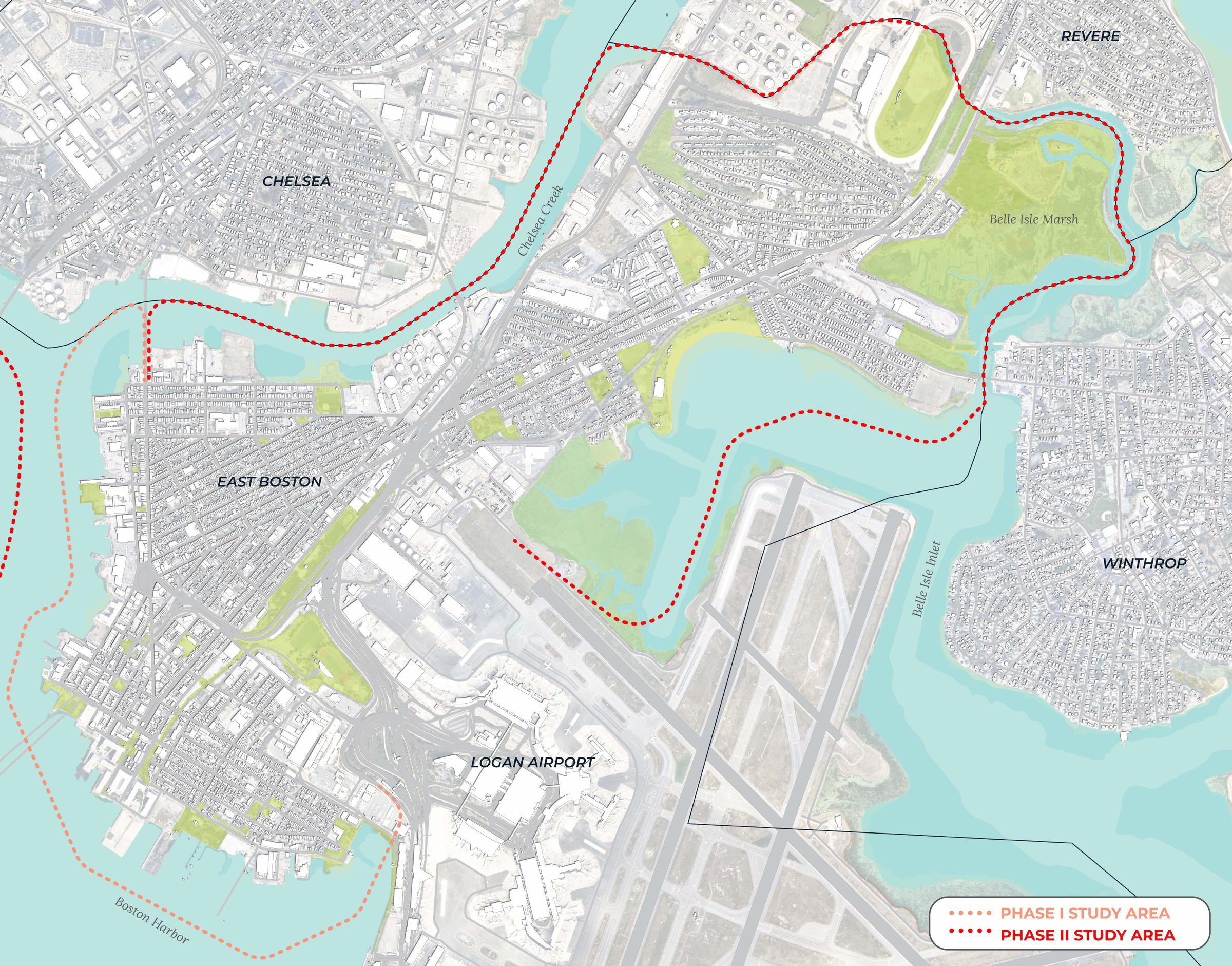
The City studied the waterfront in East Boston in two phases. The plans present strategies to protect each vulnerable coastal area over time. Each strategy incorporates an analysis of current and future flood risk, stakeholder and community engagement, and preliminary design and engineering assessments. Since the release of each plan, the City and its partners continue to engage with the East Boston community as we further the design and development of coastal resilience projects to build a resilient waterfront for all.
The Phase I plan was completed in 2017 and studied the waterfront from Logan Airport to Chelsea Creek, including:
- Jeffries Point;
- Maverick Square;
- Central Square; and
- Lower Eagle Hill.
The Phase II plan was completed in 2022 and studied the remainder of the East Boston waterfront, including:
- Chelsea Creek;
- Belle Isle Marsh;
- The Orient Heights Rail Yard;
- Constitution Beach; and
- Wood Island Marsh.
Learn more about in-progress projects and completed projects along the East Boston waterfront and how you can stay engaged in the implementation process below!
In-progress projects
Belle Isle Marsh Regional Collaboration
The City of Boston is participating in a regional working group to develop coastal resilience strategies surrounding the Belle Isle Marsh.
Resilient Bennington Street and Fredericks Park
The City of Boston, in partnership with the City of Revere, has been awarded a grant to advance the design of coastal resilience strategies extending along Bennington Street in East Boston and Frederick's Park in Revere.
Resilient Border Street Waterfront Project
The City of Boston is launching a project to advance the design of coastal resilience infrastructure along the Border Street waterfront in East Boston.
East Boston Resilient Waterfront Project
The project completed a 30% schematic design to address flooding around Carlton Wharf and Lewis Mall. An application for funding through FEMA's Hazard Mitigation Grant Program has been submitted for final design and construction, which is under review.


